Posts

Posts uit 2014 tonen

The Earth is not flat, and it is certainly not round!

Afbeelding
One year ago my friend went on a journey on the ' Oosterschelde ', he sailed from New Zealand to the Falkland Islands crossing the South Pacific and rounded Cape Horn. Together with other sailing enthusiasts, he endured the elements of the ocean and enjoyed the many exciting times he had onboard. As you may have read in my previous post , I gave him a GPS receiver for an experiment I wanted to do. He placed it on board in good view of the sky and turned it on. Despite several reception losses (storms or other effects), the data clearly shows the path of the journey. They started in Auckland, New Zealand, where they departed on the 30th of October 2013, to set sail to Chatham Island. This small island is governed by New Zealand and is closely situated to the International Date Line. Lets say the day starts on Chatham Island. After a small visit on the interesting island, the 'Oosterschelde' and its travelers started the long crossing of the South Pacific. The cros

The start of construction of the TUDelft satellite tracking station: DopTrack

Afbeelding
Monday 20 October 2014, we started the construction of DopTrack, a satellite tracking station on top of the tallest faculty of Delft University of Technology for students to use in satellite orbit determination. I will try to report on our findings of building it in this blogpost. We are in the process of setting up a dedicated website, but for now you have to do my blog ;) Project DopTrack As a master student, I followed several courses on orbit determination and satellite data analyses in the Astrodynamics & Space Missions group. During this time, I also observed the design and launch of two cube-sats of the space system engineering group. I was inspired by what students and university staff could accomplish. Come on, they launched two satellites in space. SPACE!!! However, after launch and succes of the missions the satellites were left alone. It would be cool to combine the use of these satellites and the knowledge from satellite data analyses courses. So I decided, when

My first estimates of the gravity field of the Rosetta comet, 67P/Churyumov-Gerasimenko

Afbeelding
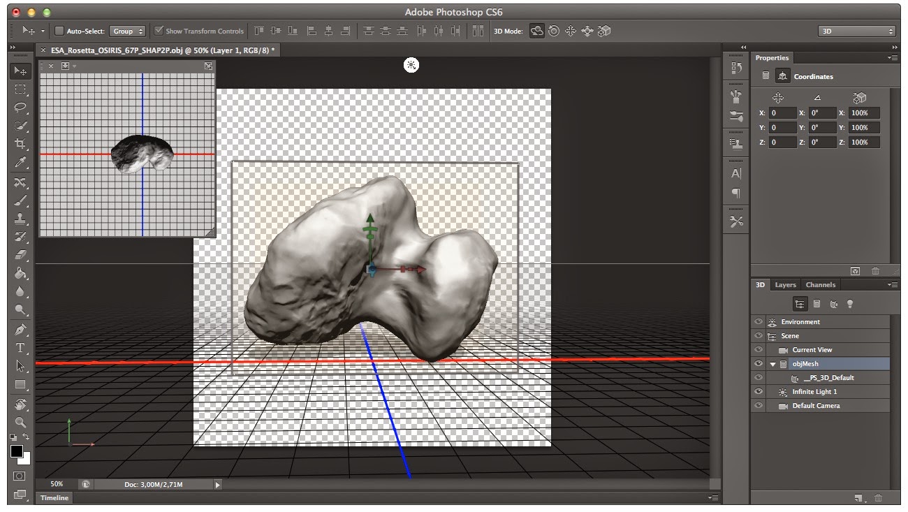
Last week, I saw a very incredible photo compilation. The Rosetta ESA satellite is currently orbiting a comet in outer space. Onboard is a camera, that is constantly taking pictures of the object. On thursday 2 October, the ESA Rosetta blog showed active geysers, shooting water of the comet out into space. What we learned as a kid, we can now see with our own eyes (well via the camera lens, a high-data space downlink, and a remarkable team in the ESA Operations & Science). Active geysers on a COMET !!!!!! Amazing. After re-finding myself from being blown away by amazement, I continued browsing this blog . There, I found that they had build a 3D model of the comet and you (as an internet user) could download it to built your own comet. Totally awesome, unfortunately, I do not have a 3D printer. Nevertheless, I downloaded the files from the blogpost ( see here ). You can download .wrl and .obj files. Clicking on the .obj file, opened the comet in Adobe Photoshop. Look at that, I

The tale of the two tides

Afbeelding
Last week, I was sitting on the beach looking at the " Oosterscheldekering ", one of the largest engineering constructions on Earth. It was designed to protect Zeeland from flooding during large storms and extreme high tides. As a boy I was always remembered of the power of the water (my complete family is from the island Schouwen-Duiveland, where the storm of 1953 hit hard). It gave me a sense of aw and pride, that engineers designed and build these large constructions. Maybe even, it gave me motivation to go into engineering. As I was admiring the view, I was thinking about tides and their cause. One of the most common questions about tides is: Why are there two high (and low) tides a day? If tides are caused by the Moon, due to its gravitational attraction, there should only be one tide a day, because the Earth rotates only ones a day, right? The answer to this problem is: Correct Frame of Reference! Since we, humans, know the Earth is round, we tend to place

Gravity Expeditions at Sea: Promotion movie

Several blogpost are about this historic project I am working on. We, together with people of the library of the TUDelft, are describing the work and voyages of one of the most adventurous scientist and professor of my university, Professor Vening Meinesz. In the beginning of previous century, professor Vening Meinesz measured Earth's gravity field onboard several submarines of the Dutch Navy. Me, being a geoscientist with experience in gravity field modelling, was asked to explain his work and relate it to Solid Earth Science. Diving into his work and stories, I became very enthusiastic and motivated for the project. We are in the middle of the project and are asking people to help us in any way they can. For this purpose (and because we live in a media-type world), we have made a promotional video. And I wanted to share this first version of the film. Please be aware! You will see me talking science :). If you like the movie and the project, please share it among your friend

The Waddensea Experiment: combining sailing and science

Afbeelding
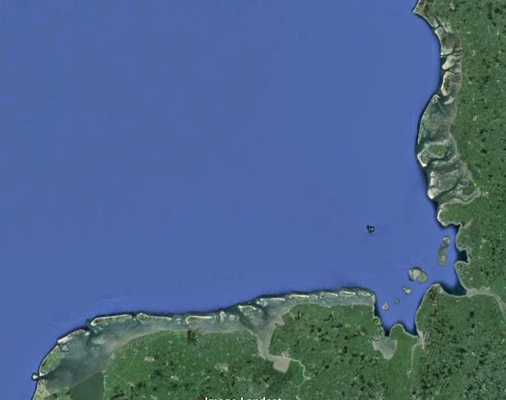
Last week, I read in the papers that the Danish part of the Waddenzee is also put on the World Heritage List. This means that the complete Waddenzee (Dutch, German and Danish) is a protected nature site. Me, as a strong admirer of this region, makes this news happy and content! It also gave me new inspiration for a blogpost. In this blogpost I will look at an experiment that I did on the Waddenzee. At the end I will prove that the Earth is round (or more precisely, not flat). The Waddensea is an area north of Holland, north-west of Germany and west of Denmark. when inspecting any atlas or google Earth, you can spot a row of islands from west to north-east. In between these islands and the mainland is the Waddensea, with all its beauty!  The Waddensea is the area between the mainland and the small islands. The Dutch, German and Danish part can be seen. Special about this region is the large influence of Earth's tides on the landscape and nature, the Waddensea is a ver

Onboard a submarine

Afbeelding
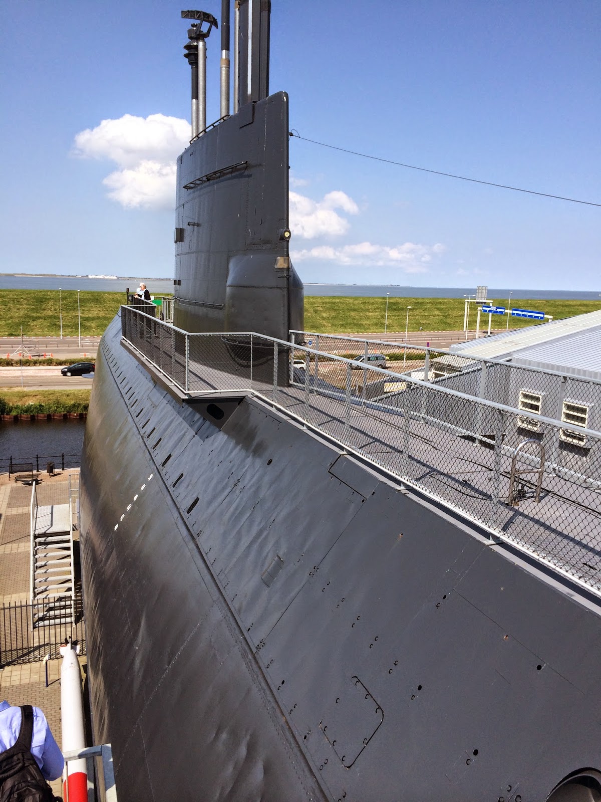
Last week, I could cross something from my bucket list. As the title already hints at, I was onboard a submarine. Ok, the submarine was not submersed in the ocean, it wasn't even in the water, but it was a real submarine, the Hr. Ms. Tonijn ("Tuna"). You can visit this submarine in Den Helder at the museum of the Dutch Navy. However, our project group (Vening Meinesz, I wrote about this) and I were guided by one of the officers that had served on board the Hr. Ms. Tonijn, who gave us an incredible tour inside the submarine. The Hr. Ms. Tonijn was in service between 1966 and 1991 for the Dutch Navy, so it is a more modern version than the Hr. Ms. K18, but some technical details, as we will see, are almost similar. This three cylinder submarine was designed by ir. M. F. Gunning with the top cylinder, being the living quarters and visitable in the museum. The bottom two cylinders contained the massive diesel and electric motors, as well as the chemical battery compartme

Gravity Art: "The Face of the Earth viewed by a Gravity Scientist"

Afbeelding
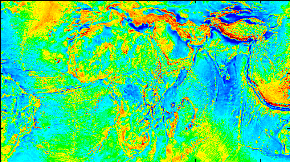
Last week I visited a conference which had the theme: "The Face of the Earth". At the conference were very inspiring talks and interesting scientists. It gave me new inspiration for my blog and my PhD research. It also gave me artistic creativity. So enjoy my art work titled: "The Face of the Earth viewed by a gravity scientist!" (click on figures to enlarge) The figure represents the free air anomaly of the Earth. This anomaly is the deviation of the gravity signal from the main ellipsoidal signal (the 9.81 m/s^2 you learned in high school). The colors represent the magnitude of the deviation. So more mass is red and blue means less mass then the main signal (green is zero). But you don't want to talk numbers, you want to enjoy the colors, because that is art all about. The above picture is of course the old continent Africa. You can clearly see some nice features in the gravity field. In the middle of Africa (Congo) is a large blue area, showing the l

Gravity shows the shape of Earth (I need your help!)

Afbeelding
I need your help!  A few posts ago , I tried to measure the shape of the Earth using my acceleration chips in my macbook. After a quick sensitivity analyses I found out that the precision of the chips was not sufficient to do this exercise. However, I really want to see if I can measure the curvature of the Earth by looking at its gravity field. So instead of high-tech measurements with my macbook, I want to see if a low-tech solution (a string pendulum) is more accurate. The basic physics behind a pendulum measurement. The relationship between the period (T) of the pendulum and its length (l) and the local gravity (g) is (yes, high school again): Well, this is not entirely correct, but for this experiment (keep the amplitude low!!!) it is good enough (take a look  here  to get a better relationship). So, to measure the local gravity (g) we need to know the length of the pendulum (half-measure!!!) and the period of the pendulum. So, what is my set-up? A piece of string

Listening to the sound of satellites

Afbeelding
Last week, components of the TUDelft satellite tracking station were delivered. This includes a radio, amplifiers, Software Defined Radio (SDR), a GPS-based clock and other cool electronics. We are now planning the integration of all the components in the existing ground station, which is used for the data downlink and command uplink of the Delfi-C3 and Delfi-n3Xt (both student designed and built satellites currently orbiting Earth). But how does this tracking (you speak of) works? It starts with capturing and recording the communications signal of the satellite, which is transmitted continuously (if the Sun shines on the solar cells to produce energy). This is where all the fancy and complicated electronics play a role. (However, I am not an expert in this, so I will only explain the physics behind it). The high frequency (145.870 MHz) electromagnetic signal is down-converted to a signal that can be made digital, such that a computer can process it. First we put the signal throug

Propagating trajectories

Afbeelding
It is many weeks since my last blog post, my humble apologies! I was very engaged with my work. I was teaching students the wonders of Planetary Sciences, which is a difficult task, because 80 percent of them just wants to build satellites (damn you engineerings, wanting to built stuff). However I do not complain because this year's group is really participating and some of the students even want to do some science (mate). In one of their last assignments they had to work with ballistic trajectories (calculating planetary geysers and volcanic exit velocities). This particular subject gave me inspiration for a new blog post, so there you go. Ballistic trajectories always interested the minds of many young boys (and might a say girls) and I have a great story about it, but I was always hesitant to write it in my blog. Some would say (me being one of them) that guns are bad (but can be modeled very well with ballistic trajectory theory)! Still my fascination for modeling and scie